University of Perpetual Help enhances learning through outdoor education


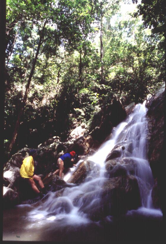
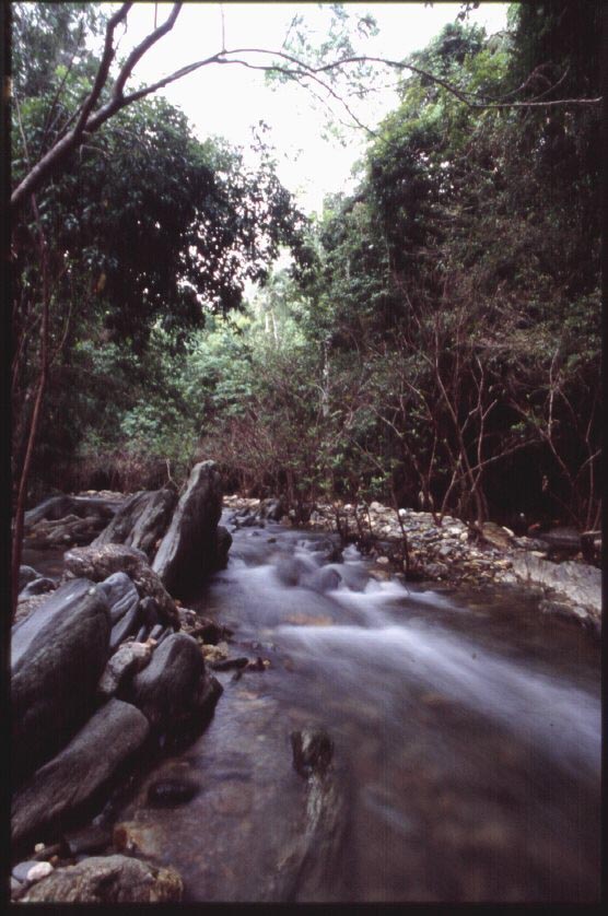
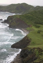
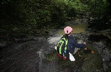
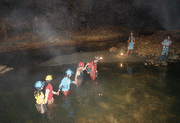
More than 170 students of the University of Perpetual Help - Dr. Jose G. Tamayo Medical University signed up for a fun-filled and highly education program called Marine Environment Exposure Tour or MEET. The program was designed by Louie and Chen Mencias to provide an opportunity for students to learn about environmental issues and consequently increase their awareness on practical solutions. Using the outstanding features of La Luz Resort in San Juan, Batangas, the participants went through three activities - a tidal pool interpretation, snorkeling activity in the fish sanctuary and a mini-adventure race.

Although the program had been running for four years, NSTP Coordinator Andre Capuyan said that this has been the most hilarious so far. In the mini-adventure race where students answer questions pertaining to a lecture on the marine environment, they were also required to perform certain activities that promoted team work, raised their level of confidence, encouraged leadership and tested their ability to follow instructions. On the race towards the finish line teams were required to don on funny costumes, lock arms and work their way towards the finish line as one unit. One student remarked,"We learned so much from this experience. I wish that I can go through it again, and again and again..."


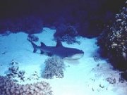
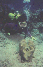
Some have mixed emotions regarding which was their favorite activity. First timers say that wearing the mask and snorkel was such an unforgettable experience for them. They absolutely love seeing fishes and live corals and floating above such a colorful and wonderful ecosystem that most people take for granted. Some even start out being afraid of the water. Proper facilitation provides a pleasant exposure that allows participants to go beyond their comfort zone and explore an environment that is totally alien to them. Fear is replaced with appreciation and concern. A few even considers the experience life changing.


To some the mini-adventure race tops it all. The aura of competition provided the right motivation for them to work as a team, follow instructions and have fun at the same time. A slight modification in the activities made it even more challenging. This year, students had a chance to get on a kayak and paddle their way around the raft and back to shore. As more emphasis is given on the concept of global warming, students were able to articulate their ecological footprint and carbon emission. Concepts that used to be as foreign as ET. These two concepts represent one's impact on the environment on a daily basis.


Dr. Larry Avelino, NSTP Director was pleased with the feedback and looks forward to more exposure trips for their students in the future. Outdoor education has been proven to develop life skills and make people more capable to handle issues in their lives and in their communties. Schools are encouraged to bring their students outside of the classroom and go through meaningful experiences that will teach them to become responsible citizens.

For more information on how your school and students can benefit from this program, send an email to wildexpeditions@yahoo.com.

U.P.SKIN DIVING CLASS EXPLORES THE REEFS OF LIGPO AND SAN PABLO


Forty college students of the University of the Philippines Diliman enrolled in the Skin Diving class of Louie Mencias stayed at Diver’s Sanctuary in Ligpo, Lemery to explore reef areas and apply their skills in the real marine environment. Aside from a few, most of them have snorkeled in the sea for the first time. With mask, snorkel and fins they swam over the shallow reef areas between the resort and Ligpo Island.


They saw several Pacific blue starfish, brittle stars, clownfishes in their anemones, butterfly fishes, several species of hard corals, basket sponges and other reef fishes and marine life forms. On the second day, they were taken by boat to the reef in San Pablo,fronting Dive and Trek Resort.


While most of them thought that their experience in Ligpo was awesome, the one over in San Pablo was even more incredible. They were able to feed the fishes by hand and had close encounters with various species of reef fish including the sergeant major or abudefduf which is abundant in the area. There were also several species of parrot fish that are used to seeing divers, hence are not afraid of people. The reef is a best practice site for reef rehabilitation and enhancement. It's case study was featured in the book "Sustainable Solutions" compiled by Ford Foundation and launched during the World Summit on Sustainable Development (WSSD) in South Africa in 2002.


Through clam restocking conducted by the Marine Ecosystem Council, Inc. (MEC) the reef sprang back to life and became valuable both to fishery and tourism. MEC was co-founded by Mr. Mencias in the mid 90's and he headed this volunteer organization for eight years. The students were likewise amazed at the giant clams (Tridacna gigas) that were on the reef. They were seeded eight years ago and grew in size. Most of them are now spawners, contributing millions of eggs and sperm in the water column that serve as food for fishes. They are also dispersed by currents and waves to nearby reef areas. Clam restocking in marine protected areas (MPA) has been proven to restore damaged and over-fished reef areas. As long as the seeded clams are protected and left on the reef, they become source of nutrient and food and provide a good substrate for corals.

Much gratitude goes to Mr. Allan Lao, manager of Diver's Sanctuary Resort for being such a gracious host. Many thanks to Karlo Yap, former President of U.P Marine Ecosystem Council (UP-MEC) the student organization of MEC for taking all the wonderful photos in this article. Thanks also to Roxy Bugayong, another ex-President of UP-MEC and member Apple Adan for joining the group and providing support. To the students who joined the activity, may you explore the marine environment more and in your own ways become stewards of this valuable resouce.


Wildlife in the Classroom program promotes the deepening of the learning process through purposeful outdoor activities. Authentic learning promotes the assimilation of "life effectiveness skills" that capacitate humans to be responsible global citizens. As one student pointed out after the field trip,"Thank you for the wonderful experience... It was my very first time to go out of the city and it would be my most unforgettable experience. Everything I saw on television, in the newspapers and in magazines, I saw in real life....The experience helped me build my self-esteem and trust on myself."

Let us know how outdoor education changes you. Leave your comments and suggestions.

For more information on clam restocking, visit www.ecorephil.blogpost.com. To learn about the link of environmental protection to tourism, visit http://www.tourismplan.blogspot.com.

Down to Earth in Cagayan


From ME magazine January 2006
I am more of a seasoned diver than a spelunker, but an invitation to a caving expedition in Cagayan was too great to resist. After all, Cagayan is known for its more than 300 caves, most of which are still unexplored. After being told that we will be entering wet caves, I took my wet suit, fins and buoyancy compensator along with my caving hat and explorer lights. Feeling like a cross between a diver and a mountaineer, I joined a team for an adventure to the caves of Baggao.
It is famous for Blue Water and Duba cave systems, two unconnected caves that present their own challenges. It was the middle of summer and yet Blue Water is very wet, and we had to do a lot of swimming and crawling through gushing water. In the first main chamber is a waterfall that drains into a huge lake. The team measured the depth in the middle of the lake with a depth sounder – it measured seven meters or 24 feet. The water was cold but refreshing – the kind of cold that stings the skin but does not penetrate the bones.

With fins on, my companions and I swam across the dark water towards a waterfall – better than having to scramble across slippery rocks and boulders along the edge of the lake. As we got closer, the force of the water pushed us back such that we had to swim diagonally across the flow to get to the water’s edge. The waterfall drop was not high and we managed to climb up to the top. Stalactites adorn the ceiling and interesting formations lined the tunnel like sculptures in a gallery. Crystals embedded in the rocks sparkled when light was shone on them.

A deep cut on the rocky terrain shows the power of water to shape and mold hard rocks formed millions of years ago. The subterranean river, which runs across the cave system creating sumps, tubs, streams and waterfalls, was such an enchanting sight, and the sound of gushing water reverberated across the long corridor. I can only imagine how much water drains out through this cave during the rainy months. Some chambers must get cut off due to flooding.

Blue Water is a newly discovered cave system and it presents many opportunities for exploration. The water is indeed blue and flows out through the mouth and into a lovely river. Several mini waterfalls and pools fringed with beautiful ferns and exotic plants line the river, making the hike a photographic delight.
In Duba, the challenge was to crawl through a small hole against a strong surge of water in order to get to the next open chamber. At one point, I had to hold my breath and grasp a rope to avoid being washed away by the current. It was an adrenaline pumping experience, to say the least.

Before heading back to Manila, we stopped over at Peñablanca, a mere 30 minutes drive from the provincial capital, Tuguegarao. It is accessible by well-paved roads and offers lodging facilities. Blessed with numerous cave systems, 4,136 hectares in Peñablanca were declared Protected Landscape in 1992. There are 378 caves in the area and only 75 had been documented by the National Museum in 1977.
Considered a spelunker’s haven, Peñablanca offers caving at various levels of difficulty, from simple day explorations to multi-day extreme caving. Callao is the best known and developed, and is a popular tourist destination. Of its seven chambers, three have dramatic natural skylights. A chapel was even built by the local folks in one of its chambers.
Callao is enormous in size, but is not challenging as Sierra, where I had to belly-crawl through a 7.5 meter wormhole called Celica’s Passage. The beautiful speleothem and speleogems are all worth the effort. But the guide told us that Odessa, Jackpot and San Carlos caves are even more difficult. Shafts and drafts mean serious roping and rappelling. They are all flood-prone and require a lot of swimming through passages, sumps, lakes and cascades. Odessa-Tumbali measures 12.6 kilometers and is said to be the third longest cave system in the country. San Carlos is considered the most technical, and one of the most challenging in the Philippines. A subterranean river runs through it and there are a lot of tight spaces that require crawling – not the place for claustrophobes.
As my friends and I relaxed along the banks of the Pinacanauan River, thousands of hungry bat flew in pulsating formations from the safety of the cliff-top caves to feed in the forest. To witness the circadian flight was the perfect finale to a week-long exploration of some of the country’s most beautiful cave systems. I have barely scratched the surface, and I am eager to return for more exciting explorations and wonderful discoveries.

A ton of learning from a heap of trash


It started out as a simple photo shoot for a documentary on reef trash. The place was a coastal village ironically named Barangay Anak Dagat(Child of the Sea) in Lemery, Batangas. The situation that met us provided me with an inspiration to conduct several trips afterwards, to educate participants on the concept of Environmental Investigation. The coastal area of Lemery is littered with all sorts of trash that the residents claim mostly come from other areas. They are brought in by the wind and the waves, specially during the southeast monsoon or habagat. What fascinated me was the fact that the people living in this place seem to have adapted to the condition. They have accepted the fact that the beach will always be littered with trash and that no matter how much they clean, new waves of garbage will end up on their shores. Some have already given up cleaning since they have no place to put them anyway. There are no collection system and no waste management is being implemented. Life goes on such that everybody goes through their routine everyday, unmindful of the dirty environment.

Children play among the garbage, fisherfolks haul in fish from the numerous fishing boats parked along the shore, men and women continue to pound these fish and make them into "bagoong", men repairing nets on the beach among a pile of plastic bags. Its no longer shocking to them to see their neighbors approach the water with a drum of trash and dump every piece in the sea, this while children swim and frolic. The sea to these people is their fishing ground, their source of food and livelihood, their sink, their toilet, swimming pool and playground for their children. I am sure that such sad condition is not isolated to this place. It is a common occurence in many places in the country and the rest of the world.

Lubang's Onoda Trail

From Health and Lifestyle March 2003
For most people from the city, the name Lubang is often equated with the Onoda story. Back in 1974 Lt. Hiroo Onoda, a Japanese soldier who held out in the jungles of Lubang island for 30 years after the war, surrendered. He was trained in guerilla warfare before he was sent to the Philippine is 1954. He received instructions to proceed to Lubang, destroy Tilik port with explosives and lead the remaining soldiers in the fight against the Americans. Most of the Japanese however were either killed or caught as prisoners. But a few remained deep in the jungles and continued their fight. The last to give up his arms was Lt. Onoda who refused to believe that the war was over despite the fliers that were scattered by plane, magazines left along the trails and pleas from friends and relatives. When he surrendered to former President Ferdinand Marcos 32 years ago, he was still wearing his uniform that was patched up in many areas, held his sword that was polished and well maintained, and saluted like a dignified soldier. Lt. Onoda is now 81 years old and lives in a farm in Brazil.
When I assembled my team to explore Onoda’s jungle October of last year, I came prepared. I bought and read the book entitled “No Surrender” which Onoda himself wrote, and was translated in English. Here, he describes in details how he came to Lubang, ended up holed up in the jungle, how he survived for 30 years without being caught and living off from the produce of the land. It was quite an interesting story and provided an insight to the man who was treated as a hero by his countrymen upon his return to Japan.
Our expedition to Lubang was part of the local government’s effort to come up with a sustainable tourism development plan highlighting on the Onoda Trail. The team was composed of seasoned mountaineers, a geographer, tourism field workers, a photographer and community members who served as our guides. We started our journey from a place called Vigo. A dump truck took us from the town of Lubang to a point up in the hills of Vigo until the truck couldn’t go any further. We hiked with our packs following our guides who hacked with their bolos to create a temporary trail. We went through thick growths of shrubs, vines, giant ferns and stinging plants. For a time we followed a small stream covered with large boulders that formed steps going up a steep slope. As we went deeper into the jungle, the trees became bigger and the air became cooler. Due to the extensive canopy of the forest our GPS could not even read any satellite.
After two hours we reached a plateau covered with age-old trees. By this time we could smell the strong odor of bat guano. We proceeded westward until we got to a wall of limestone almost completely covered with vines and plants. Two large boulders conceal an opening that goes into a small cave. As soon as we clambered in, bats started flying out from a dark corridor. This is one of the several caves where Onoda hid during his stay on the island. We hang out for a while, trying to imagine how he could have survived here and what went on in his mind. When his last two companions Private First Class Kozuka and Corporal Shimada were still alive, they would travel through a circuit that they have created. It starts from Gonting, a place along the south shore, and goes in a counterclockwise direction, coursing through the mountains in the central sector of the island. They transfer from one site to another, staying from 3 to 5 days in each place, covering the entire circuit in a period of one month.
When one of my team members got stung by a plant called lipa, we decided that it was time to move on and head towards Vigo River. Our local guide pointed to other local plants that have hairs and carry some kind of stinging cells. We tried to remember how they look like and realized that they were quite a bunch of them along the trail. We ended up ducking our heads and avoiding rubbing our bare skin against them.

We headed east across canyons and steep slopes. An hour’s hike led us to the banks of the beautiful Vigo River. Two of our local guides who went ahead much earlier were already there with a sack-full of freshwater shrimp. They caught them in the river with a net. A fire was built, and while the rice and shrimps were being cooked, we walked along the water’s edge and marveled at the multi-colored rocks. Carved by time and the elements, the rocks come in various shades of pink, yellow, orange and green.
After lunch, we proceeded south and followed the river. It winds through the jungle and every now and then shows evidence of its power and might. At some point large trunks of dead trees rest along its banks amidst shrubs that lean towards the waters flow. While there are deep quiet pools, the river also has some shallow, tumbling brooks making it possible for us to cross countless times. The thick canopy of the trees lining the banks provides a habitat for many species of animals. While we hiked, we were treated to a symphony of bird calls and sounds of insects, beautifully blending with the sound of running water. Standing in the middle of it all, and gazing at the patterns of leaves against the blue sky, we felt so far away from civilization. We were engulfed by nature as nature should be.
Vigo barangay captain Manuel Villaflores emphasizes the need to protect the forest and this river system. He adds,” Onoda’s presence somehow helped protect the forest of Lubang.” People were afraid to go up the hills and log. It’s been 32 years since he surrendered and yet this valuable ecosystem has retained its integrity. The Onoda Trail is a legacy and asset that Lubang can certainly capitalize on its plan to promote sustainable tourism.

Peace for the Wilderness

From Action Asia October 2003
Our 14-meter outrigger boat worked its way carefully down the narrow river of Baler, the capital of Aurora province and the starting point for our expedition. Lining the banks were thickets of nipa, the broad-leaved plant used by the locals for roofing…and brewing the local wine. Twenty minutes of sluggish chugging through the heat and humidity brought us to the river’s delta. The boat lurched from right to left as it struggled through the surf zone, and soon we were cruising north along the eastern coast of Luzon towards one of the Philippines’ most remote and pristine wildernesses: the Northern Sierra Madre Natural Park.

Ten people had signed up for the expedition, a good mix of scientists, outdoor enthusiasts and environmental educators. We were looking forward to exploring the eastern border of the Park where it meets the mighty Pacific Ocean, an inaccessible region genuinely untouched by the modern world. In particular, geologists Dr. Fernando Siringan and Rose Berdin from the University of Geological Sciences were hoping to find examples of Porites, a huge type of coral that can grow to 8-9 m in diameter if left undisturbed. They have disappeared from around much of Luzon due to dynamite and cyanide fishing, but the hope was that the isolated region (there is no road access at all to the area) might harbour some examples.

Porites are important thanks to the bands of different density coral within them. These can be read like tree rings: thick, low density bands form during periods of fast growth, when conditions such as sea-surface temperature, salinity, wave action, sedimentation, nutrient load and light intensity are favourable. Similarly, at times when conditions are more difficult, the coral grows more slowly, making them potentially good indicators of the relative health of the marine environment.


In addition to our scientific aim, we were also going to position a terbum (a Tibetan peace vase) in an underwater location in the park as part of the World Peace Vase Programme, which involves deploying 6,000 vases worldwide. Peace vases are filled with medicine, precious substances and mantras and are traditionally used by Tibetan Buddhists to protect important places against misfortune and promote positive healing energies. Each of the 6,000 in this programme had been consecrated by His Holiness Dilgo Khyentse Rinpoche, a highly respected spiritual leader.

Passing San Ildefonso Point, the water became calmer, as summer’s southwest wind was blocked by the mountain range running parallel to the coast. It’s not always this way: for almost half of the year the coastline is battered by gigantic waves rolling in from the Pacific. The ocean rules supreme during this period and no boats dare venture out this far. Numerous caves, tidal pools, pockmarked cliffs and dramatic rock formations stand testament to the ocean’s enormous power. Its wild, windswept, primeval coastline – paradoxically ideal for Porites which are massive enough to withstand the waves and are therefore protected from human interference.


The Northern Sierra Madre Natural Park is the largest protected area in the Philippines, covering an area of 359,500 hectares, and one of ten priority areas for environmental protection and management. Its coastal area is characterized by a narrow strip of tropical of tropical beach forest dominated by agoho trees, that look strangely out of place since they resemble pine trees. Patches of low shrubby vegetation also occur, interspersed with dwarf trees with twisted trunks and crooked root systems. From the boat, we could see long stretches of white sandy beaches reflecting the midday sun brightly, backing onto steep mountain ranges covered by a thick canopy of evergreen dipterocarp rainforest, and lower montane and mossy forests higher up. Breaking this swathe of green were long silvery streaks that regularly cut across the thick forest cover as precipitous waterfalls fed by constant mountain streams drained into the sea. In a span of two hours, I counted as many as 15 waterfalls falling directly onto the beach.

“Has it always been this beautiful?” I asked Dolsing Rostaquio, the captain of the expedition’s boat. He has been traveling this route for more than 30 years and knows its features, moods and seasons. “Ever since I can remember, this part of Luzon has always been like this. Nature has made sure that this place rests from human intrusion for most part of the year. The Pacific Ocean destroys and yet protects,” he replied, speaking in the local dialect.

Protect she certainly does. The semi-nomadic Dumagat, an indigenous tribe who live in these coastal areas of Luzon, have been isolated from modern civilization for centuries. At Divinisa – a lovely river delta fringed with white sandy beach – we came upon a group of these short, dark, curly-haired people. The Dumagat live off the land, gathering almost everything they need from the forest and sea. To them the wilderness is their home, market, medicine cabinet and place of worship.


A young man named Udok, clad only in a string loincloth, told me he was a forest ranger. Dumagat men have been trained by the government to be stewards of their domain. They were given outrigger boats with which to patrol their areas of jurisdiction, but as Udok said,”It is a nice title but we had been doing this even before the government came. This is our home and we need to protect it. If we allow people to come in and destroy it, it is like allowing ourselves to die.”

Further north, we camped beside an enchanting waterfalls on the beach. In the water freshwater shrimps have developed a single claw that they use to grasp rocks to avoid being washed away by the swift current. Our team decided to climb up the rock wall and explore the upper reaches of the gorge.

From the lip of the falls, the long beach stretched away, foaming surf crashed down on it endlessly. A flock of white seagulls swooped down on the water to snatch fish, purple herons circled their nests stop rocky outrcrops, and numerous tidal pools acted as natural tubs filled with busy marine life. Inland the undulating green peaks of the Sierra Madre marched into the distance. A 20 minute hike upstream revealed a secret garden blooming with pastel-colored flowers. Pitcher plants, orchids and vines grew in wild profusion around a mini-waterfall that flowed into a small pond. This idyllic discovery filled us with a real sense of purpose as we returned to the waterfall at day’s end and rappelled down it back to the beach.


The following morning as I watched the sunrise from the window of my tent, Udok’s words came back to me. The Northern Sierra Madre Natural Park is indeed a superb example of the Philippine’s natural treasures, and as such it is vital to protect it by any means. The sun climbed slowly from the horizon, rising between two rocks that resembled shark’s fins, and suddenly I realized that this was the perfect place for the peace vase.

We donned our diving gear, and entered the water to explore the outer reef and search for a suitable site for the vase. The surge can be monstrously strong at certain times of the year, so we needed to find a place where it wouldn’t be dislodged. The underwater terrain here on the Pacific coast of Luzon is dominated by rock formations, pinnacles, pillars and small caves. It is not an ideal place for coral growth, battered as it frequently is by storm waves and currents. Nevertheless, some sturdy species grow, including the Porites that our geologist friends had hoped to find, and also plenty of seaweed anchored to the bare rock.

We worked our way along the sandy bottom at 25 m, struggling against the forward and backward movement of the water even at this relatively calm time of the year. Having to deal with the surge meant we consume our air faster than usual, and we were almost out of air by the time we reached a group of tall rock pillars rising from 18 m to the surface. Past these submarine towers we came upon a slope with several large round boulders. They seem to be of uniform size and shape, but closer inspection revealed carpets of seaweeds and algae wrapped around them.

We had been underwater for some 30 minutes, and we were now in shallow reef. Suddenly a hawksbill turtle appeared from nowhere, and as if guiding us, passed in front of us and landed on one of the round boulders. An emperor angelfish materialized from under the rock and hovered close to the turtle. I peaked underneath and discovered a small cave just big enough for the vase. I checked with my dive light in case it was inhabited by a moray eel or some other territorial creature, but there was nothing. I motioned to my companions and they all nodded in agreement.

We returned to the surface and on the second dive brought the peace vase with us. Weighing around 18 kg, it required two lift bags to be brought down to the correct depth safely, then once neutrally buoyant it was transferred horizontally through the water to its new home, where it was carefully placed.

The expedition was concluded after eight days. As we headed back to Baler, a pod of dolphins swam in the wake of our boat, as if escorting us back to the modern world from an untouched Eden. We felt exuberant and fulfilled, both from a scientific viewpoint and a spiritual one. As scientists we hope our report will aid understanding large tracts of pristine land such as the Northern Sierra Madre Natural Park. And as members of the global community we hope the small but symbolic act of placing the peace vase will also have some beneficial effect, no matter how ethereal.

Enchanting Palaui Island

From Health and Lifestyle August 2006

From the bow of the outrigger boat I watched the waves crash against the rocky shore. It was in the middle of the rainy season and several waterfalls slash across the cliffs of the western coast of Palaui Island. I could not believe it but I counted a total of 24. The island is a watershed. Rain water that falls on its forest ends up absorbed by the soil or taken in by creeks, streams and rivers, then eventually drains out to the sea.

The island is part of barangay San Vicente, Sta. Ana, Cagayan. It is located 642 km. north of Metro Manila. It is also part of the Cagayan Special Economic Zone and Freeport that is being managed by the Cagayan Economic Zone Authority or CEZA. In August 16, 1994, the entire 7,415 hectare island was declared a Marine Reserve under the category of Protected Landscape and Seascape. Like all protected areas in the country, the island is managed by the Protected Area Management Board, a multi-sectoral group that decides on the sustainable use of its resources. Palaui Island had been identified as a priority site for tourism development. It is a place that will soon become a hub for a special brand of tourism that focuses on outdoor education. The natural ecosystems of the island provide a perfect venue for several outdoor activities that will teach people the value of resource conservation and protection.

CEZA Administrator Jose Mari Ponce said that Palaui was chosen as the priority site because tourism not only has the potential to provide economic benefit but also serves as a tool for conservation. He added, “ CEZA promotes sustainable tourism so that we make sure that Palaui Island and all other tourist sites within the zone remain destinations for generations.”

Indeed, the landscape and seascape of the island are stunningly beautiful and well preserved that they need to remain such for many years. Tourism can be beneficial but it can also destroy. Irresponsible tourism result to vandalism, garbage problem, collection of plants and animals for souvenirs and cultural erosion. Louie Mencias, tourism consultant of CEZA said, “ Palaui Island is envisioned to be a place where tourists will learn to value natural ecosystems. By participating in outdoor activities such as hiking, kayaking, snorkeling, boat tours and community immersions, they will learn to be responsible travelers. They will behave in a manner that will contribute to the preservation of the place that they visit.”
When my boat reached the northern most tip of the island, a structure peaks from atop a hill. It is a light house that was built in 1888. Faro de Cabo Engaño stands at 92.75 meters above sea level and provides an excellent view of the forest, the nearby Dos Hermanos Island, as well as the Pacific and Babuyan Channel. This landmark provides a historical and cultural element to the island’s interpretative program. It is a place where one can see both the sunrise and the sunset unobstructed.

As I view the light house from the boat I could not help but think of the hardship that the workers must have gone through when they were building it. It was said that 78 people died during its construction due to illness brought about by the harsh condition of the island back then. Today, Sta. Ana is accessible by land and has hotels, pension houses, resorts, restaurants and private houses for authentic homestay experience. Local transport sector that include van, tricycle and boat operators are well organized and provide mobility. Boats bring tourists from Port San Vicente to Punta Verde, Siwangag and Cape Engaño while island guides accompany visitors along hiking trails.

Climbing up to the light house was quite a feat but was worth all the effort. The panoramic view as well as the interesting landscape and vegetation provide more than adequate reward. Wild carabaos, horses and birds are just some of the interesting faunal species of the place. They are often spotted grazing on the grasslands and open spaces, often running off into the forest when disturbed.
As I traverse the trail from Cape Engaño in the north to Punta Verde in the south, I was enthralled by the rich biodiversity of the forest. Several streams criss-cross and drop in mini-waterfalls. Vines, orchids, lichens, berries, diptherocarp trees, palms, ferns and other flowering and fruit bearing plants thrive in profusion. The thick forest canopy provided a natural umbrella for me and for the many life forms that live on the forest floor. When the rain stopped, shafts of light beamed through the leaves like lasers, creating a surreal atmosphere. Specks of sunlight danced among plants of various forms, colors and textures. A resource inventory recently conducted by Conservation International and the University of the Philippines Institute of Biology reveals species that are globally threatened and near threatened. Scientists who have visited the island all agree that biodiversity of both the terrestrial and marine ecosystems is high.

Palaui island in endowed with primary and secondary forests, mangrove areas, seagrass meadows, tidal pools and coral reefs. It has the potential for several outdoor sports that are also tools for exploration. The reefs around the island are excellent for snorkeling and SCUBA diving. The forest trails which are being prepared for nature interpretation are excellent for educational hikes, and camping. The tidal pools, mangrove forests and shallow reefs areas are ideal for coastal environmental exposure programs.


Local residents envision the island to remain intact even if the mainland becomes urbanized. 108 families living on the island serve as stewards. Their lives are entrenched and connected to the natural environment. Tourism is a non-extractive industry and relies on the integrity of the destination for its sustainability. Active participation in the promotion of a community-based tourism industry will not only result to economic and social benefits but will also provide justification for the protection of the place.
After hiking through the woods for more than five hours, I emerge in the midst of the community fully aware that this island paradise will one day serve as a place where visitors will learn values pertaining to the care for nature, appreciation of history and respect for culture. The smiles and warm reception from the people reflect hope, sense of pride, passion and a positive outlook for the future.